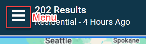
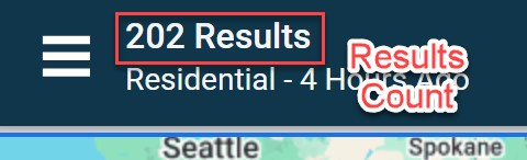
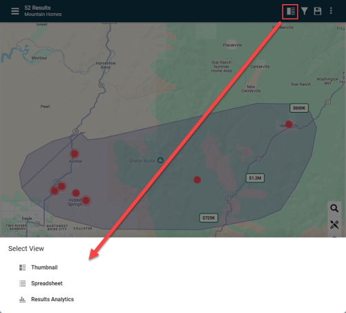
Search Results: Maps

Map Searching: Video Tutorial
Map Searching
Expand each section below to learn more.
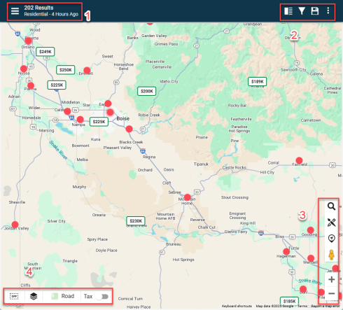

Pro Tip: Use binocular icon ![]() to find desired fields and Criteria Summary icon
to find desired fields and Criteria Summary icon  to narrow down to only see fields being used
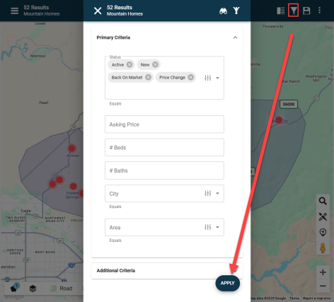
After making updates to an existing saved search, click the floppy disc icon  to save the search.
To save a new search, click the same icon, name the search, and use it as you would other Saved Searches.
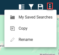
My Saved Searches - Open your library of Saved Searches
Copy - Creates a copy of the search in use. Use to preserve a specific, original search and then make changes on the copy based on user needs.
Rename - Rename the existing Saved Search
Type desired location into the search bar and select from drop down list
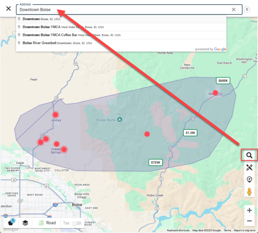
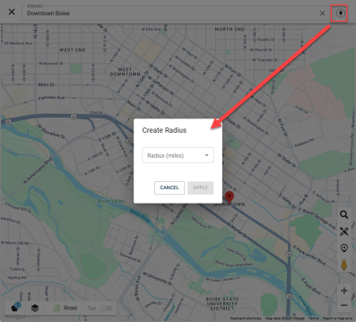
Refine results by creating a radius around the point of interest
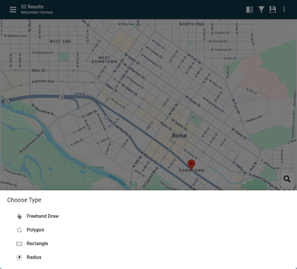
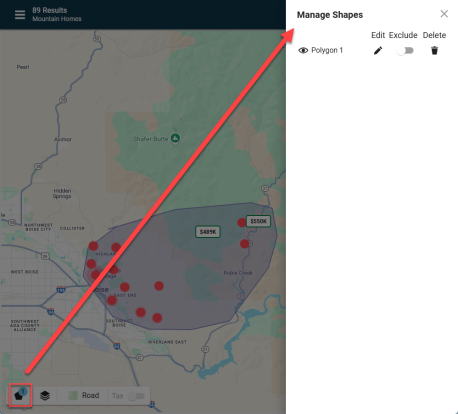
Click on the brush tool icon in the bottom right menu on the Map
![]()
Then select the desired style to generate the shape on the map.
Note: After generating shapes, manage the shapes with the bottom left menu (defined below)
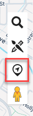
Clicking on the "center on location" button moves the map to center on the user's location using the location services built into the user's device.
You may have to "allow" this when using this feature for the first time.
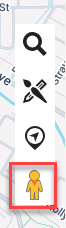
Click on the pegman and drop it on a desired point on the map to open the street view.
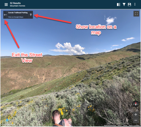
This will open the street view of the specified location. Use the new menu at the top left to navigate the street view.
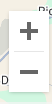
Use these buttons at the bottom right to zoom in and out on the map
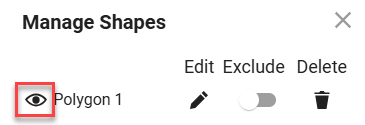
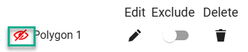
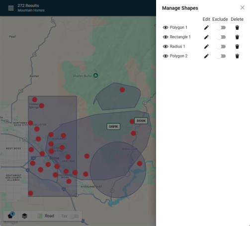
After adding shapes on the map from the Bottom Right toolbar, click on "Manage Shapes" at bottom left to work with shapes.
This is what the button looks like when shape is displayed on the map:
This is what the button looks like when shape is hidden on the map:
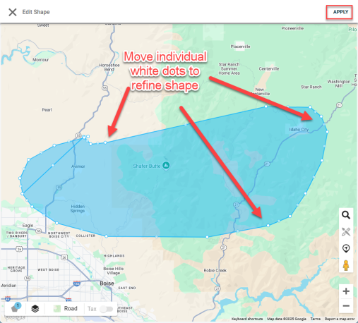
Clicking on "Edit" button will open "Edit Shape" editor for user to move white points on the map to refine the shape.
Click on "APPLY" to save changes.
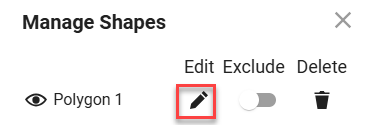
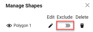
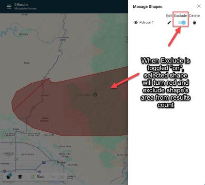
Toggle Exclude button to keep showing shape on map but exclude shape area from results count.
When Exclude is toggled "on", selected shape will turn red and exclude shape's area from results count.
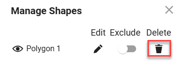
Removes shape from map.
Users can use multiple shapes on the map to refine search results.
Each shape can be configured using the buttons described above.
Shapes will be named after type of shape and then by number, e.g. "Polygon 1", "Polygon 2", etc.
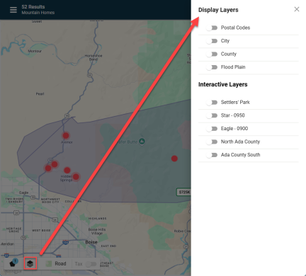
Open the Map Layers window to toggle on/off layers on the map.
"Display Layers" section is for basic area designations.
"Interactive Layers" section is MLS specific. May not be available in all areas.
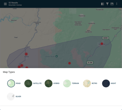
Click on "Road" in the bottom left menu to open the various Map Types.
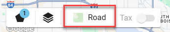
Select the Map Type
*More info coming soon
